The Best Path for Vehicle Routing
FUANGROD Todsaporn
Meakawa's Lab
Abstract
At the present, we have used management vehicle routing technology and shared with database or GIS (Geographic Information System), which consists of road, lodging, building and the others. The best path is based on this information and algorithms for finding. Somebody believed that the shortest path is the best path but in some case shortest path isn't the best path. The shortest path uses the Dijkstra's algorithms. This research combines the fuzzy logic algorithms with the Dijkstra's algorithms to support the decision for finding the suitable path.
OBJECTIVE
Finding the path for vehicle routing on GIS by use Dijkstra's algorithms, the shortest path, and adding the condition between calculating that use Fuzzy logic for more efficiency decision. Result of calculating is the best path for vehicle routing in this time.
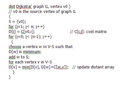
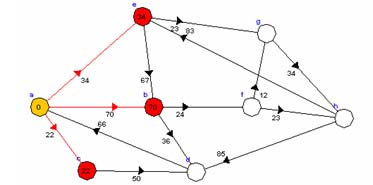
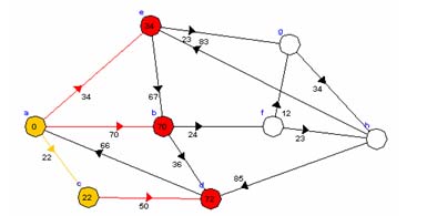
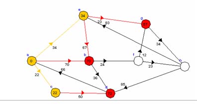
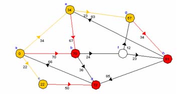
Dijkstra's algorithms
This algorithm finds the routes by cost precedence. Let's assume that every cost is a positive number. G may be a graph, a digraph, or even a combined one, which means that only some of its sides are directed. If we consider G as digraph, then every other case is fully covered as well since a no directed side can be considered a 2 directed sides of equal cost for every direction
Methodology
The shortest path is measured from only distance (weight) between node to node. If you want to travel the best path, compare the other except only distance such as traffic jam, crowed, dangerous way, weather etc.
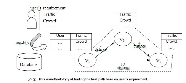
At first, I match between user's requirement and database for the system can know requirement and find the best for user. Then each node has the information and the distance of connection of the next node. The path is calculated by fuzzy logic and base on Dijkstra's algorithm.
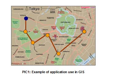
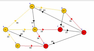
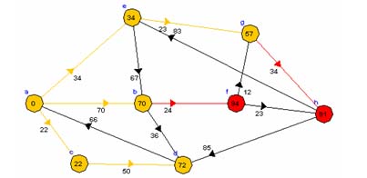
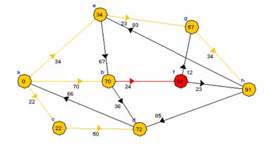
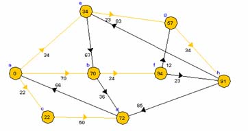
Example
Future Plan
To study Fuzzy Logic theory and how to combination between fuzzy logic and this program